2021 Vol. 40, No. 5

Display Method:
CONTENTS
2021, 40(5)
Abstract:
Inversion of time-frequency electromagnetic well seismic modeling to probe the inner structure of deep volcanic reservoir: A case study of LD area in Bohai Bay Basin
Suo Xiaodong, Dong Weibin, Shi Dongyang, Li Yuezheng
2021, 40(5): 1-10. doi: 10.19509/j.cnki.dzkq.2021.0501
Abstract:
The seismic reflection of volcanic reservoir in deep basin is disorderly due to the influence of energy shielding, which makes the exploration of volcanic reservoir very difficult. Aimed at the complex inner structure of deep volcanic reservoir with multi-phase superposition, the optimal offset, time-frequency electromagnetic acquisition technology of the excitation period window, time-frequency electromagnetic well seismic joint modeling inversion and electrical variation rhythm coding volcanic period interpretation technology are studied, which effectively improved the depth resolution and the recognition ability of the method. The research and application effect in LD area of Bohai Bay Basin are obvious. The results show that the volcanic eruptions of the third member of Shahejie Formation in the Red Star tectonic belt show the characteristics of "two strong three weak" of "weak-strong-strong-weak-weak" from bottom to top. Two volcanic eruption mechanisms are developed, which jointly control the distribution of volcanic reservoir facies in five periods. In Taoyuan structural belt, the volcanic eruption intensity of each stage of the third member of the Shahejie Formation is significantly weakened, and only one volcanic eruption mechanism is developed. Except for the relatively large distribution range of volcanic reservoir facies in stage 3, the volcanic rocks in other stages are mainly confined to the crater, mainly in eruption facies, and their scale is significantly reduced. The follow-up drilling results confirmed that the distribution of volcanic reservoir revealed by time-frequency electromagnetic was correct, which provided strong support for the large oil and gas discovery in this area and provided a successful example and technical methods for the detection of similar complex targets.
Tectonic deformation and its constraints to shale gas accumulation in Nanchuan area, southeastern Sichuan Basin
Tang Jiguang, Wang Kaiming, Qin Dechao, Zhang Yue, Feng Tao
2021, 40(5): 11-21. doi: 10.19509/j.cnki.dzkq.2021.0502
Abstract:
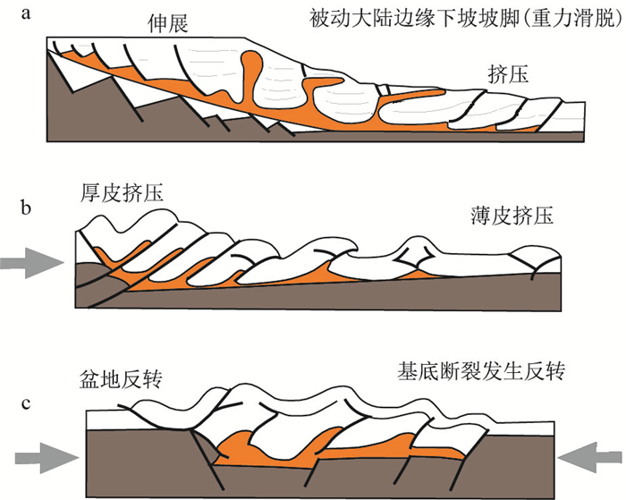
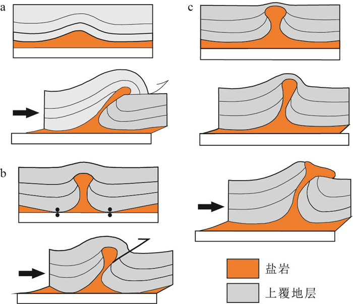
Since the gas generation of Lower Paleozoic marine shale, it has suffered from strong structural transformation, resulting in complex enrichment law of shale gas in Nanchuan area. In order to reveal the constraints of Mesozoic and Cenozoic tectonic deformation to shale gas enrichment, through fine structural analysis, and the analysis of evolution time series, and main controlling factors of shale gas enrichment, the structural model is constructed, the Mesozoic and Cenozoic tectonic evolution process is restored, the main controlling factors of shale gas enrichment are determined, and then the response relationship between structural style and shale gas enrichment model is analyzed. The study shows that the tectonic deformation strength gradually weakens from east to west in Nanchuan area, and there are two propagation structural modes: strong thrust fold-break-slip in the northern section and strong thrust fold-break slip in the south ones.In the middle Yanshan period, the main NE trending structures were developed, and Pingqiao and Dongsheng structures were formed in the time. At the end of the middle Yanshan period, due to Jinfoshan uplift and Nanchuan-Zunyi fault, the southern section underwent structural superposition and transformation. The early NE trending structure evolved into a north dipping monocline, and a nearly SN Yangchungou anticline was developed on the east side of Nanchuan-Zunyi fault. Due to differential structural deformation, anticlinal shale gas rich structural style is developed in the fault fold belt, and the shale gas rich structural style is monoclinic in the outer edge belt in the north section, while monoclinic and anticline ones are developed in the structural superposition belt in the southern section. The preservation conditions of shale gas are restricted by the structural deformation mode. The preservation conditions of shale gas gradually become better from east to west in the northern section, while the shale gas ones are more complex in the southern section. Among them, three structural styles such as low angle monocline, wide and gentle anticline and wide and gentle anticline are favorable shale gas enrichment structures in the northern section.
Types, characteristics, and implications on the exploration of far-source oil reservoirs in the north Melut Basin
Shi Zhongsheng, Xue Luo, Ma Lun, Chen Bintao, Wang Lei, Pang Wenzhu, Shi Jianglong
2021, 40(5): 22-32. doi: 10.19509/j.cnki.dzkq.2021.0035
Abstract:
The Melut Basin is an important petroliferous basin in African Continent. The northern part of the basin is characterized by far-source oil accumulation with the oil generation in the Lower Cretaceous and the oil accumulation in the Paleogene. Clarifying the formation conditions and controlling factors of the far-source oil accumulations is the key to improve the exploration success rate and seek new potential areas of far-source oil accumulations in the Melut Basin. Based on the study of regional petroleum geological conditions and the analysis of key oil accumulations, the formation conditions, types, characteristics and potential exploration areas of far-source oil accumulations in the Melut Basin have been systematically studied. The results show, ①The north Melut Basin develops two types of far-source oil accumulations with different hydrocarbon charging patterns and accumulation modes in the Paleogene Yabus Formation, the far-source fault-lithology combination oil accumulations within the oil kitchen and the far-source fault-block oil accumulations outside the oil kitchen; ②The formation of far-source oil accumulations of the Yabus Formation inside oil kitchen depends on the coupling of three geological conditions, that is, the "two strong and one weak" three-stage rifting cycles, creating conditions for the formation of the Paleogene Yabus-Adar far-source reservoir-caprock combination; the development of oil-rich sag, providing necessary oil supply for the Yabus far-source traps; and the multi-stage rifting activities, providing vertical migration pathways for hydrocarbon charging in the Yabus far-source traps; ③The far-source oil accumulations inside oil kitchen are mainly charged by the vertical hydrocarbon infilling through the oil-source faults, and the oil-source faults are the main controlling factor for the hydrocarbon accumulation. The identification of oil-source faults and the evaluation of the lateral sealing capability of trap-controlling faults are the key elements for the far-source fault-block traps inside oil kitchen; ④The far-source oil accumulations outside oil kitchen are mainly charged by lateral hydrocarbon infilling from the oil-rich sag. The transportation ridges formed by sand-rich strata, fault blocks and paleo-uplifts control the hydrocarbon accumulation of far-source traps outside oil kitchen. The identification of transportation ridges and the study on the hydrocarbon charging extent are the main evaluation focus of far-source traps outside oil kitchen. The research results successfully guided the exploration deployment and in-depth exploration of far-source oil accumulations in the Melut Basin, and have a great implication on the exploration of far-source oil accumulations in the other petroliferous basins.
Structural characteristics of the Western Branch of the Tanlu fault in Bohai Sea and its control on the formation of buried hills
Li Huiyong, Xiao Shuguang, Li Fei, Sun Zhe, Liu Kai
2021, 40(5): 33-41. doi: 10.19509/j.cnki.dzkq.2021.0503
Abstract:
The Western Branch of the Tanlu fault in Bohai Sea refers to the Western Branch fault of Bohai segment of the Tanlu fault, the formation and evolution of which plays an important role in controlling the distribution of pre Cenozoic strata and the development of the structure of buried hills.Based on the data of 3D seismic, drilling and experimental data, the structural characteristics, genetic evolution model of the Western Branch of the Tanlu fault in Bohai Sea and its control on the formation of buried hills are analyzed.The results show that: ①the Western Branch of Tanlu fault in Bohai Sea is characterized by multi-stage superimposed activities in Indosinian, Yanshanian and Himalayan.The activation of late Himalayan is weak, and it is concealed under Cenozoic sediments.②The Western Branch of the Tanlu fault in Bohai Sea is divided into three segments: north, middle and south by nearly EW trending fault.There are some differences in the structural deformation patterns and strength of each segment in the key geological period.③The Western Branch of the Tanlu fault in Bohai Sea was originated from strike slip transition caused by uneven N-S compression in Indosinian.④Indosinian-Yanshanian strike slip thrust and associated folds in the Western Branch of the Tanlu fault in Bohai Sea are the key factors controlling the distribution of strata buried hills and the formation 19-6 buried hill structures of Bozhong.The research results can provide a basis for oil and gas exploration in Bohai Sea.
Numerical simulation of sedimentation in the Central Canyon of Lingshui area, Qiongdongnan Basin
Wang Xinguang, Zhang Hui, Chen Zhihe, Tian Dongmei, Li Wenrui, Zhang Dongyue, Cao Licheng
2021, 40(5): 42-53. doi: 10.19509/j.cnki.dzkq.2021.0026
Abstract:
Deepwater canyon is now the focus of the research field of offshore oil and gas exploration.In the Qiongdongnan Basin of the northwestern South China Sea, several deepwater exploration boreholes have been deployed in the Central Canyon to reveal the lithologic hydrocarbon reservoir of sediment infill therein.However, due to the relatively limited number of these boreholes, the large distance between each borehole, as well as the low resolution of seismic data, the issues regarding the superposition relationship between different sandstone bodies within the canyon, their contact relationship with boundaries, and sedimentary evolution remain poorly understood, which severely hinder the delicate characterization of reservoir physical properties.This study investigates the Lingshui area of the Central Canyon from the perspective of numerical simulation of sedimentation.Geological and mathematical models are established based on the specific geological observations.The hydrodynamic simulation software ANSYS FLUENT is used for the forward modeling of multiple sedimentary stages and sandstone bodies with different initial conditions (e.g., provenance and inlet velocity) to reveal the geometry of modeled turbidite sedimentation, including the horizontal and vertical distribution patterns of sandstone bodies.The simulation results show that: Within the straight section of the canyon, the flow rate and intensity of the turbidity current gradually decrease due to the effect of substrate friction; Relatively coarse and fine particles can be deposited on the substrate and suspended along with the vortex at the head of the turbidity flow, respectively; Within the narrow section of the canyon, the turbulence of the head of the turbidity flow is strong enough to erode the canyon wall and also shift the strike of the canyon.Suspended particles can be affected by centrifugation force to form the overflow sedimentation; In addition, the results show a vertical heterogeneity of sandstone bodies distributed within the canyon: sandstone bodies are usually interlayered by mudstone that features a small thickness and poor lateral continuity.A comparison with the available seismic and borehole data shows the validity of the obtained simulation results.This study attempts to reveal the hydrodynamic processes in terms of different sedimentary stages and sandstone bodies, and then to predict the configuration of sandstone bodies that provides a favorable basis for reservoir prediction.
Accumulation conditions and main factors of the Lower Carboniferous Tianeping Formation in Lianyuan Sagin the middle of Hunan Province
Tian Wei, Chen Xiaohong, Li Xubing, Yue Yong, Li Hai, Liu An
2021, 40(5): 54-63. doi: 10.19509/j.cnki.dzkq.2021.0504
Abstract:
Lower Carboniferous Tianeping Formation shale is a new shale gas exploration bed in Linayuan Sag of Xiangzhong Depression.Based on the filed geological investigation, shale gas drilling wells, sample collection and laboratory analysis, the shale gas accumulation conditions of Carboniferous Tianeping Formation in the sag were discussed in this paper, such as distribution characteristics, geochemical characteristics, reservoir characteristics and gas content.The results show that the total organic content of the shale is high and distributed from 0.78% to 2.84%.The organic matter types are mainly type Ⅱ1.The thermal evolution degree of the shale is mainly in high mature with the range of 1.48%-2.09%.The shale composition is mainly quartz and clay minerals which are mainly composed of illite/smectite, illite, and chlorite.The pore of organic matter is more developed in mud shale.The porosity and permeability of shale are 2.43% and 0.285×10⁻³ μm2 in average respectively, but the permeability of most of the samples is less than 0.1×10⁻³ μm2.The gas content of shale of Tianeping Formation in Well Xiangxindi 4 ranges from 1.64 m3/t to 4.29 m3/t, with an average of 2.69 m3/t (without residual gas).Combining with the regional sedimentary-tectonic background, we suggest the sedimentary environment and structural preservation conditions are the main controlling factors of shale gas accumulation conditions of Lower Carboniferous Tianeping Formation in Lianyuan Sag.The basin facies are the favorable facies belt for shale gas, and the syncline formed by the hedge structural style under the complex structural background is the most favorable for the preservation conditions of shale gas, which is the sweet spot area for shale gas exploration in the study area.The research results can provide reference for subsequent oil and gas exploration in this area.
Constraint of the isotopic age of asphalt Re-Os on the age of hydrocarbon accumulation in Fanjingshan area in Northeast Guizhou
Yu Ning, Peng Wei, Chen Youzhi, Ma Mingzhe
2021, 40(5): 64-70, 82. doi: 10.19509/j.cnki.dzkq.2021.0505
Abstract:
Fanjingshan area in Northeast Guizhou is located at the northern margin of Xuefeng Uplift. The black organic rock series developed from Precambrian to Early Paleozoic, and the asphalt is widely displayed. The Neoproterozoic-Mesozoic period in this area experienced the Jinning period, Caledonian period and Indochina-Yanshan movement multi-stage tectonic deformation. Previous studies mostly focused on the response relationship between the structure and hydrocarbon accumulation in the latter two periods, while the matching relationship between the structure and hydrocarbon accumulation in the Jinning period has not been reported. In this paper, Re-Os isotopic study was carried out on bitumen in limestone dissolution cave of Baota Formation in Fanjingshan area. The isochronal age is (915±129)Ma. Combined with the regional geological analysis, it is concluded that there are primary oil reservoirs of Jinning period in Fanjingshan area, secondary oil reservoirs were formed in Caledonian period, whose distribution was controlled by paleouplift. In summary, this study enriches the oil and gas accumulation stages in the north margin of Xuefeng Uplift, and also promotes the study on the mechanism of secondary reservoir accumulation under complex tectonic deformation. It is of profound significance to the exploration of Neoproterozoic oil and gas in South China.
Characteristics and mechanism analysis of geothermal field in Nanle Sub-uplift, Bohai Bay Basin
Huang Xu, Zhang Hui, Wang Xinwei, Li Qingyao
2021, 40(5): 71-82. doi: 10.19509/j.cnki.dzkq.2021.0506
Abstract:
In order to explore the characteristics of karst reservoir and the genetic mechanism of the Nanle geothemal field in Bohai Bay Basin.Based on geophysical and geological data, this paper analyzes the factors of the geothermal field that include karstic reservoir distribution, hydro-chemical characteristics, migration channels and geothermal, and eventually we construct the conceptual model of the geothermal field. The results show that there are four stages of Ordovician weathering crust karst heat reservoirs in the Nanle geothermal field, including Caledonian, Indo-Hercynian, Yanshan and Xishan. The burial depth of the Ordovician karstic reservoir is 1 427-2 135 m (effective thickness: 46.2-91.7 m). The reservoir is characterized by good caprock and geothermal gradient (3.04-3.24℃/hm), and the groundwater is SO4+Cl-Na+Ca-B type. It is considered that the geothermal field is a conductive one, which was formed in the west slope belt of Dongpu Sag-intracontinental basin in the high heat flow. And the system is characterized by the cold water that deep into the bedrock of cycle that influenced by thermal refraction and redistribution effect of heat flow and friction heat generation of Lanliao fault, which along the regional unconformity and fracture migration, enrichment, whose recharged water source comes from atmospheric precipitation in the Taihangshan and Luxinan, and finally concentrated in Ordovician karst heat reservoir of the Nanle Sub-uplift. The total extractable geothermal resource of the Ordovician karstic reservoir in the Nanle Sub-uplift geothermal field is 1.02×10⁹ GJ (3.5×10⁷ t standard coal eqv.), and the annual geothermal resource can meet the indoor heating demand of 0.124 million square meter. The geothermal field has a good market potential.The results have a good guiding significance for the development and utilization of karst reservoirs in the south of Bohai Bay Basin-Nanle geothermal field.
Recognition and characteristic analysis of the transition boundary for transform marginal basin: A case of Cote d'Ivoire Basin, Africa
Gai Haiyang, Jiang Ye, Zhang Ke, Wang Wei
2021, 40(5): 83-90. doi: 10.19509/j.cnki.dzkq.2021.0033
Abstract:
This paper takes the typical transform passive marginal basin, eg.Cote d'Ivoire Basin as the research object, starting from the transitional edge of the basin, by using comprehensive analysis of various data.We identified two types of transform margins in the marginal basin and summarized respective characteristics; we also compared the differences between two types of transform margins in stratigraphic development, fault systems, volcanic activity, stress fields and different impact on the basin.Through the research of this article, it is believed that a typical transform continental margin basin has two different types of ocean-continent transform margins: transitional margins and transitional discrete margins; There are significant differences between the two types of margins in terms of contact relationship, volcanic activity intensity, and transformation of early strata; The transform continental margin basin structure is controlled by both early faults and transitional faults system.Especially at the transform discrete margins, tensile and strike-slip stresses are overlapped.After multi-stages of structural transformation, the early fault system has dual properties of strike-slip and tension, and multi-stages structural transformation also has a significant impact on oil and gas migration, accumulation and preservation.Early faults near the conversion faults may undergo reversal effect, and the nature of the early faults may change, resulting in compression structures or stratigraphic reversals.
Geometry and kinematics of the Aure fold-thrust belt, Papua New Guinea
Wang Deliang, Mei Lianfu
2021, 40(5): 91-98. doi: 10.19509/j.cnki.dzkq.2021.0507
Abstract:
The Aure fold-thrust belt is an important area for oil and gas exploration in Papua New Guinea, but the structural deformation and evolution of the fold-thrust belt are not well understood.In this paper, 2D and 3D seismic data, drilling and geological data covering the structural belt, combined with previous geological research results, were used to identify the structure and kinematics characteristics of the Aure fold-thrust belt.Guided by the theory of fault-related folds, the seismic data are interpretation.The Aure fold-thrust belt can be divided into three sections along the strike, and the structural deformation of the belt has obvious differences, which are mainly reflected in the following aspects: ①In the trend from NE to SW, the deformation level is gradually shallow, the involved strata are gradually new, and the deformation degree is gradually weaker; ②Along the strike from NW to SE, the extension range becomes smaller, the foreland sedimentary strata become newer, the tectonic deformation time becomes later, the shortening rate becomes larger, and the shortening amount becomes smaller; ③The western section and the middle section are disintegrated vertically, and the eastern section is inherited deformation.The results can provide basin evidence for oil and gas exploration in Papua New Guinea and regional tectonic evolution in the northern margin of Australia.
Geochemical characteristics and its paleo-environmental significance of the Lower Cambrian carbonate in the northwestern Tarim Basin: A case study of Well Shutan-1
Zhang Chunyu, Guan Shuwei, Wu Lin, Ren Rong, Xiong Lianqiao
2021, 40(5): 99-111. doi: 10.19509/j.cnki.dzkq.2021.0508
Abstract:
Recently, subsalt exploration in the Tarim Basin has been one of the most significant targets of the deep hydrocarbon exploration.The Lower Cambrian Xiaoerbulake Formation is the major reservoir in current exploration.However, the analysis of the detailed geochemical and paleoenvironmental characteristics are limited in Keping area in absence of studies in the interior of the basin.This paper focuses on the Well Shutan-1 in the Bachu Uplift of the northwestern Tarim Basin.Based on the analysis of petrology and the geochemical characteristics (major, trace, rare elements and carbon-oxygen isotope), depositional environment of the Lower Cambrian Xiaoerbulake Formation is explored.Our study indicates that the lower, middle and upper part of the Xiaoerbulake Formation in Well Shutan-1 comprise thick algal dolomite, mudstone interbedded with dolomitic limestone and fine to silty dolomite, respectively.The average value of Lan/Ybn is 1.09 in the Xiaoerbulake Formation, of which the lower and upper part show positive Eu anomaly.Silica cementation, silica fragment and dissolution can be seen in the thin section, indicative of hydrothermal influence.Redox-sensitive trace elements are enriched in the middle of the formation.V/Cr and Ni/Co range from 2 to 4.25 and 5 to 7.The grain size of the sediment is finer.These are indications of suboxic bottom-water condition.The RSTEs and their ratios are relatively low in the upper and lower Xiaoerbulake Formation.The grain size of sediment is coarser.These are indications of oxic bottom-water condition.The carbon isotope ranges from -1.3‰ to 2.7‰. It decreases firstly and then increase throughout the interval.Two positive and one negative isotope excursion are identified in the lower and middle part of the interval, respectively.Paleoenvironmental reconstructions indicate that paleo-salinity firstly increased and then decreased.Paleo-seawater temperature gradually increased.Dolomite reservoirs were well developed in the late stage due to moderate salinity, occurrence of algal dolomite along with later weathering and dissolution.The research results can provide a basis for oil and gas exploration in this area.
Structural characteristics of Jan Mayen microcontinent and tectonic evolution model of volcanic passive margin in distal domain
Jiang Ye, Liu Qiong, Zhang Yingde
2021, 40(5): 112-122. doi: 10.19509/j.cnki.dzkq.2021.0031
Abstract:
With the deepening of global oil and gas exploration research, the North Atlantic polar region has gradually become the frontier of oil and gas exploration, but the exploration degree of Jan Mayan micro-continent is very low.The study on stratigraphy, structures and tectonic evolution modelling of the Jan Mayan microcontinent (JMMC)is presented in the paper based on seismic, gravity and magnetic data newly acquired by CNOOC in its contract area and other new published papers which show the most update progress of the JMMC. Located in the central part of the Norwegian-Greenland Sea of the North Atlantic, the JMMC is conjugate with the Jameson Land Basin on the Greenland continent margin and the Vøring Basin on the Norwegian shelf margin of the Beltic Continent in accordance with similar Paleozoic-Mesozoic stratigraphy. The JMMC extends southwards from the Jan Mayan fracture zone towards northern Iceland and its architecture shows the characteristics of detachment faults which is similar to the Mesozoic fault system of the Vøring Basin. The distribution of SDR, volcanic intrusion and explosion can be interpreted on the seismic data which indicates the JMMC is the distal domain of the volcanic passive margin in the North Atlantic mostly during the Cenozoic age. The tectonic evolution model is setup by analogic basin analysis and is supposed to start from the Paleozoic-Mesozoic orogeny to rifting, and then be influenced by the twice seafloor spreading of the age 55 Ma and 25 Ma. The first seafloor spreading of 55 Ma age caused the continental crust break-up and formed the volcanic passive margin between the Greenland and Beltic, especially the JMMC's separating from the conjugate Norwegian shelf margin. The second seafloor spreading of 25 Ma age caused the oceanic ridge jump due to the Iceland mantle plume drifting off the Greenland and also caused the JMMC's separation from the Greenland Continent as an 'abandoned orphan' floating on the oceanic crust. The meaning of this study is to discuss kinematic evolution of residual continental crust detached from the distal domain of the plate and to indicate lithospheric extension and break while the embryonic oceanic crust generating through the detachment movements and mantle upwelling.
Analysis of deformation and stress evolution of thrust structure: A case of Jurassic in east Kuqa Subbasin
Pang Feifei, Tang Yong, Song Huanxin, Tang Wenjun
2021, 40(5): 123-135. doi: 10.19509/j.cnki.dzkq.2021.0509
Abstract:
Thrust structure is a relatively common structural form, and its deformation process from weak to strong and the quantitative distribution of stress are not very clear. This study analyzes the tectonic profile in the eastern part of Kuqa Subbasin, and according to the complexity of deformation, the thrust tectonic activity can be divided into four stages: initial stage, development stage, mature stage, and reformation stage. And it uses the finite element calculation and analysis method to carry out detailed numerical simulation calculation on the different stages of the section. Research suggests that the expansion of the thrust structure is not a simple linear development process, but a process of continuous migration and advancement of the front and rear wings. A simple thrust fold is the initial stage of the thrust structure, and the stress is mainly concentrated on the rear wing; after deformation, it expands to the rear wing and the end area increasing continuously is the development period of the thrust structure, and the stress is mainly concentrated on the end; it expands to the front wing after deformation and the wing range beginning to increase is the mature stage of the thrust structure, and the stress is mainly concentrated on the end and the front wing near the end; the rear wing is tilted, the front wing is vertical, and a large number of new thrust faults developed at the front edge of the front wing are thrust structures; it is the period of thrust structural transformation, and the stress is mainly concentrated on the front edge of the front wing. To clarify the difference in the deformation process of the thrust structure and the distribution range of the stress concentration will lay a good foundation for the prediction of the fracture development position and the abnormal development zone of overpressure in the later stage.
Compressional salt structures of salt-bearing sedimentary basins and its significance to hydrocarbon accumulation
Wang Li, Wu Zhenyun, Yin Hongwei, Dong Shaochun, Bi Chenjie, Yang Xiulei, Wang Fuyuan, Liu Song
2021, 40(5): 136-150. doi: 10.19509/j.cnki.dzkq.2021.0037
Abstract:
The compressional salt structure is an important type of salt structure formed under the action of regional compressional stress field, which plays an important role in the generation, migration and trap accumulation of oil and gas in sedimentary basins.In the past few decades, important progress has been made in the study of compressional salt structures, which effectively guides the exploration of oil and gas reservoirs in compressional salt sedimentary basins.Based on the physical characteristics of salt rocks, deformation evolution of compressional salt structure and its influence on hydrocarbon accumulation distribution, this paper discusses the deformation evolution characteristics of compressional salt structure, and analyzes the typical salt-bearing fold-and-thrust belt at home and abroad and their hydrocarbon accumulation characteristics.And by comparing the domestic and foreign salt-bearing fold-and-thrust belt and typical oil and gas reservoirs, it summarizes that the domestic and foreign typical salt gypsum layers salt-bearing fold-and-thrust belt are involved in the tectonic deformation, made from the orogenic belt to the basin in the hinterland, tectonic deformation by the strong basement involved in thrust nappe deformation gradually transition to the thin skin decollement fold deformation, and affect the distribution of hydrocarbon accumulation in the fold thrust belts.Finally, the existing problems and future research directions of salt structure in the salt-bearing fold-and-thrust belt in China are analyzed.
Cenozoic tectonic evolution and dynamics of Turkana Depression, East African Rift
Wang Liang, Zhao Hongyan, Qiu Chunguang, Zou Yaoyao, Zheng Chenyu, Yang Chaoqun, Shen Chuanbo
2021, 40(5): 151-161. doi: 10.19509/j.cnki.dzkq.2021.0512
Abstract:
As a typical continental rift at the embryonic stage of the Wilson cycle, the East African Rift System (EARS) is a natural place for studying plate tectonic kinematics and dynamics. The Turkana area of the EARS is of special interest science, which has been influenced by pre-existing fabrics and Mesozoic rift activities. The evolution of EARS has important significance for understanding and perfecting the evolution process of continental rifts. Based on the collected low-temperature thermochronometer study results, drilling and field outcrop data, combined with seismic data, through comprehensive analysis of rift activity time and fault activity rate analysis, this study redefined the rift evolution sequence in Turkana area, and the Cenozoic rift activity in the study area can be divided into four stages of evolution. The characteristics of the evolution of the study area are summarized as follows: early stage rift began in the south and later stage in the north, first wide rift and later narrow rift, moving to the eastward. The rift evolution is generally controlled by the combined action of pre-existing fabrics and mantle plume activity. The migration of mantle activities not only affects the migration of volcanoes and rift activities, but also may change the development pattern.
Cenozoic tectonic subsidence characteristics of Albert Lake Depression in East African Rift System
Zheng Chenyu, Zhao Hongyan, Qiu Chunguang, Zou Yaoyao, Wang Liang, Hu Bin, Jia Shen, Shen Chuanbo
2021, 40(5): 162-172. doi: 10.19509/j.cnki.dzkq.2021.0513
Abstract:
The Cenozoic East African Rift is a typical intracontinental rift at the germination stage of the Wilson cycle, which has long attracted the attention of geologists at home and overseas. The Albert Lake Depression is located at the northern most end of the west branch of the East African Rift System.It is an asymmetric (half) graben with a NW orientation. At present, good industrial oil and gas have been discovered in this area.The analysis of the subsidence evolution is of great significance to further reveal the tectonic subsidence characteristics and petroleum exploration potential of this depression.Based on drilling data, combined with seismic interpretation, and analysis of subsidence history, burial history and fault activities, this paper reclassifies tectonic units, and summarizes the characteristics of tectonic subsidence. The relationship between subsidence and fault activities, the law of subsidence center migration and its indicating significance for petroleum exploration were discussed in this study. The results show that the secondary structural units in the east of the Albert Lake Depression are mainly controlled by the eastern boundary faults, and the F1 and F2 faults play a major role in controlling the subsidence and formation of the eastern steep fault belt, the eastern fault terrace zone and the three structural adjustment belts. The subsidence rate of the southern sub sag was large in the early stage, which was conducive to the formation of extremely thick source rocks in Late Miocene.With the northward migration of the subsidence center, the Upper Miocene and Lower Pliocene source rocks were developed in the northern sub sag.The structural belt around the subsidence center is the favorable direction area for hydrocarbon migration and accumulation. This study provides a new basis for further petroleum in Albert Lake Depression of the East African Rift System.
Segmentation of the movement in Indosinian of the Changde-Anren fault in Hunan: Constraints from granite
Bai Daoyuan, Li Bin, Li Yinmin, Chen Di, Ling Yuexin
2021, 40(5): 173-187. doi: 10.19509/j.cnki.dzkq.2021.0038
Abstract:
Changde-Anren fault is a large NW-trending fault in eastern Hunan Province.Based on a large number of basic geological data, this paper summarized the segmental characteristics of the fault; according to the oringin and distribution of Indosinian granite in the fault zone, the paper suggests that the activity of the fault in the main episode of Indosinian movement in the Late Middle Triassic was segmented.According to the structural characteristics of the fault and its two sides, the exposed strata and magmatic rocks, the Changde-Anren fault can be divided into four segments such as Anren-Hengshan segment (Ⅰ), Xiangxiang segment (Ⅱ), Taojiang segment (Ⅲ) and Changde-Shimen segment (Ⅳ), between which are NE-trending deep faults that cut through the deep crust and even the mantle.The NE-trending deep faults were mainly formed in Caledonian movement with sinistral strike-slipping, and cut the Changde-Anren fault into several disconnected segments, which resulted in the segmentation of the movement in Mesozoic of the Changde-Anren fault.In the region, the Late Triassic granites are mainly S-type granites formed by deep crustal melting in a post-collisional environment.The distribution characteristics of Late Triassic granites in the Changde-Anren fault indicate that the activity of the fault in the main episode of Indosinian movement is obviously segmented: there occurred shearing of the Xiangxiang segment of Changde-Anren fault in the deep part in Middle Triassic Indosinian movement, when the movement amplitude, shear strength and corresponding warming effect decreased from the middle to the end of the segment for the end restriction, which caused that the decompression-melting of deep crustal in Late Triassic only occurred in the middle part of Xiangxiang segment, and the corresponding granites were exposed in the middle and northern sections of Xiangxiang segment.This structural-magmatic mechanism is also reflected in Anren-Hengshan segment and Taojiang segment.The segmental movement of the Changde-Anren fault in Indosinian is a "passive" segmental movement after the first penetrating fault was divided into several segments by the NE-trending deep fault, which is different from the general "active" fault segmental movement or segmental growth with many small faults occurring, expanding and finally being connected into a large fault.
Metallogenic prediction of copper polymetallic deposit in the Yueyashan-Laodonggou area, Beishan Ore Belt
Duan Hailong, Chen Yao, Zhang Qing, Zhang Cheng, Cao Lei, Liu Yuguo, Tian Kenan
2021, 40(5): 188-197. doi: 10.19509/j.cnki.dzkq.2021.0043
Abstract:
The Yueyashan-Laodonggou area in the Inner Mongolia is located in the southeast of Beishan Ore Belt.Previous prospecting work in the area focuses on gold, tungsten and other minerals, wheras it rarely involved copper-related deposits.Based on the field geological survey, in combination with extraction and comprehensive analysis of indoor multivariate prospecting information, we systematically studied the geological characteristics, prospecting model and comprehensive prospecting information of typical copper polymetallic deposits in this area, and thus finally carried out metallogenic prediction.The copper in the area mostly occurs with iron, lead and zinc, and the deposits are controlled by carbonate, Paleozoic intermediate-felsicplutons and NW-NWW faults, thus can be classified as skarn-type copper polymetallic deposits.The places with NW-NWW faults, high magnetic anomalies and Cu-Pb-Zn geochemical anomalies are favorable prospecting area for such deposits.Hereby, four prediction areas (A1, A2, B1, C1) have been delineated, and high-quality mineralization and alteration are observed in two of them(A1, A2) by field verification, which points out the direction for the next-stage work in this area.
A discussion of prospecting direction for the Chelugoubei Gold Deposit in Gansu Province: The enlightening from contrast analysis of the geological conditions of "Golden Triangle" gold deposits in eastern segment of Altyn fault shearing zones
Liu Yanliang, Gao Ya, Wei Jindong
2021, 40(5): 198-209. doi: 10.19509/j.cnki.dzkq.2021.0034
Abstract:
Chelugoubei Gold Deposit in Yumen City, Gansu Province is located at the intersection of the western North Qilian Orogenic Belts and eastern Altyn Tagh Sinistral strike-slip fault shearing zones, which is a famous "golden triangle" in Northwest China. The formation of the deposit is closely related to the left-side Altyn fault shearing zone and the output is controlled by the secondary branch fault zone. The Paleozoic stratum is the main source layer of the mine, which is generally high in gold content in the region. The regional magmatic activity is strong and closely associated with the gold (mineralization) body. The Chelugou granodiorite complex provides heat source and part mine source for the deposit. Combined with the regional metallogenic background and using the method of comprehensive analogy of regional deposits, the authors compared the ore-controlling factors, such as strata structure magmatic rock physicochemical remote anomaly characteristics, as well as ore bodies, ores surrounding rock alteration and other geological characteristics of the deposits in detail, including Chelugoubei Gold Deposit, Hanshan Deposit, Yingzuishan Deposit, Dishuishan Deposit and other "gold triangle" deposits. It can be concluded that the Chellugoubei Gold Deposit has similar ore-controlling factors and very similar geological characteristics with the above-mentioned gold deposits. As an extension of the "Golden Triangle" gold belt in the Northeast China, it has the potential of concealed large-scale deep deposit. On this basis, the prospecting model of "Golden Triangle" gold deposits is further systematically summarized, and the prospecting criteria and prospecting direction have been discussed. The research result can provide some enlightenment for the further exploration of tectonic altered rock type gold deposit in this area and the North Qilian area.
Diagenetic and metallogenic ages, and geological significance of the Fujiashan skarn-type(Cu-) W Deposit, southeastern Hubei Province
Liu Quan, Li Yanjun, Cai Heng'an, Li Hongmei, Zeng Xiaohua, Sun Xiaofeng, Liu Dongqin, Tan Jun
2021, 40(5): 210-222. doi: 10.19509/j.cnki.dzkq.2021.0042
Abstract:
The Fujiashan(Cu-) W Deposit, which is discovered recently, is one of the typical skarn deposit in southeastern Hubei.The(Cu-) W mineralization is closely associated with the Fujiashan granodiorite porphyry.In order to accurately determine the diagenetic and metallogenic ages of the deposit, ages of the granodiorite porphyry and (Cu-) W mineralization are studied by using LA-ICP-MS zircon U-Pb and molybdenite Re-Os isotopic dating in this paper. In addition, the tectonic setting of diagenesis and mineralization is discussed based on the sedimentary strata, structural deformation, geophysical and geochemical evidences in the middle and lower reaches of the Yangtze River during the Late Mesozoic.The results show that the granodiorite porphyry yields a weighted average 206Pb/238U age of (144±3) Ma, whereas a Re-Os model age of molybdenite of (146±2) Ma is obtained for mineralization.These isotopic ages indicate that the granodiorite porphyry and(Cu-) W mineralization at Fujiashan both formed during Late Jurassic-Early Cretaceous.In addition, the diagenesis and mineralization ages of the Fujiashan(Cu-) W Deposit are also consistent with the time of large-scale magmatic and metallogenic events for skarn Fe-Cu-Au-Mo deposits in the middle and lower reaches of the Yangtze River.According to the history of tectonic evolution and the latest chronological data in the middle and lower reaches of the Yangtze River, including southeastern Hubei, it is considered that the Fujiashan(Cu-) W Deposit is likely to be formed in a tectonic setting of lithospheric extension and thinning.The discovery and determination of Late Jurassic-Early Cretaceous skarn(Cu-) W Deposits including the Fujiashan indicate that the ore concentration area in southeastern Hubei has a good explorational prospect for tungsten deposits.
Reservoir control of tight sandstone provenance system in Xujiahe Formation, Sichuan Basin
Yao Wenli
2021, 40(5): 223-230. doi: 10.19509/j.cnki.dzkq.2021.0036
Abstract:
In order to clarify the provenance characteristics and reservoir control of tight sandstone in Xujiahe Formation of Sichuan Basin, by means of reservoir petrology test and microscopic analysis, the relationship and distribution between provenance and reservoir development are studied, and the controlling factors of provenance system are discussed.The results show that the Xujiahe Formation reservoir in Sichuan Basin has five basic characteristics: low composition maturity, strong physical property difference, mainly medium fine grain, mainly dissolution pores and two sides of diagenetic effect; the provenance controls the development range of reservoir rock types, the plane distribution is different, and the composition and content of soluble minerals are also different, which leads to different porosity Longmenshan in the West and Dabashan in the Northeast are the main source areas of Xujiahe Formation.The former shows relatively high content of carbonate cuttings, while the latter shows relatively high content of volcanic cuttings.The stage change of orogenic activity intensity in different periods leads to the change of provenance supply intensity and types, the differentiation of reservoir rock components, and then controls the vertical heterogeneity of reservoir.The research results can provide reference for the next fine oil and gas exploration in this area.
Origins of vein-forming fluid and hydrocarbon accumulation in Shiniulan Formation in Dingshan, southeast Sichuan Basin
Luo Tao, He Zhiliang, Guo Xiaowen, Huang Yahao, Tao Ze, Chen Jiaxu
2021, 40(5): 231-241. doi: 10.19509/j.cnki.dzkq.2021.0024
Abstract:
The Silurian hydrocarbon accumulation research in the southeastern Sichuan Basin lacks evidence of the hydrocarbon accumulation and destruction stages in reservoirs. Bitumen and calcite veins that were developed in the Shiniulan Formation had recorded the information of the fluid evolution in reservoirs and have important implications for fluid activities and hydrocarbon accumulation processes in the Dingshan area, southeast Sichuan Basin. Based on analysis of petrographic, trace element, fluid inclusion and laser Raman spectroscopy of the calcite veins, this research determines the timing and origin of the paleo-fluids formed the calcite veins; recovers the paleo-pressure of the methane inclusions, and reveals the petroleum system evolution and controlling factors of the Shiniulan Formation. The results indicate that two phases of calcite veins were developed in the Shiniulan Formation, and oil charging happened before the formation of the two phases of the calcite veins. The first phase of calcite veins were formed at ~127 Ma under relative reduction conditions, with the forming fluid sourcing from the diagenetic fluid of the same strata, which show brown-red cathode luminescence colors. The second phase calcite veins were formed at ~83 Ma under relative oxidation conditions, showing brown-yellow cathode luminescence colors. Oil generation peak of the Longmaxi source rocks, which were the main source of the Shiniulan reservoirs, was from ~190 Ma to ~150 Ma. Oil to gas cracking happened at ~135 Ma. The trapping pressure of methane inclusions is 51.77-57.46 MPa, and the pore fluid pressure coefficient is 1.26-1.40. Since the Yanshanian period, a series of tectonic movements have taken place in the Dingshan area, which uplifts and lead to erosion and fracturing of the Dingshan area is accounts for the destruction of the Shiniulan gas reservoirs.
Characteristics of pore structure of intersalt shale oil reservoir by low temperature nitrogen adsorption and high pressure mercury pressure methods in Qianjiang Sag
Zeng Hongbin, Wang Furong, Luo Jing, Tao Tao, Wu Shiqiang
2021, 40(5): 242-252. doi: 10.19509/j.cnki.dzkq.2021.0022
Abstract:
In order to more comprehensively characterize the pore structure characteristics of Qianjiang Formation shale oil reservoir in Qianjiang Sag, several shale samples from Well A and Well B with different distances from the source were systematically selected for analyzing and testing, and the pore structure characteristics of shale were comprehensively analyzed by field emission scanning electron microscope, low temperature nitrogen adsorption and mercury intrusion capillary pressure experiment; Making a further study by comparing the field emission scanning electron microscope images, low-temperature nitrogen adsorption and mercury intrusion capillary pressure experimental data on the occurrence space characteristics of retained hydrocarbons in shale; The pore size distribution of connected pores in shale is discussed through the secondary mercury injection experiments on typical shale samples.This study shows that the pore size of Qianjiang Formation shale oil reservoir in Qianjiang Sag is nanometer micron scale, and 2-180 nm clay mineral interlayer pore and dolomite intergranular pore are the two main pore types in this area; The retained hydrocarbon in Well A shale mainly exists in 2-20 nm clay mineral interlayer pores, the content of retained hydrocarbon is low, and the connected pore size is mainly concentrated in the range of 3-15 nm.The retained hydrocarbon in Well B shale mainly exists in 8-100 nm dolomite intergranular pores, the amount of retained hydrocarbon is large, and the connected pore size is mainly distributed in the range of 10-130 nm.The existence of dolomite and clay minerals is conducive to the development of shale reservoir space, but the biogenic dolomite far away from the source is more conducive to the occurrence and mobility of retained hydrocarbon.The research results can provide theoretical support for the exploration and development of shale oil in Qianjiang Sag.
Formation sensitivity of landslide dam based on geomorphic characteristics
Huang Jian, He Zicheng, Huang Xiang, Wang Hao
2021, 40(5): 253-262. doi: 10.19509/j.cnki.dzkq.2021.0040
Abstract:
Landslide dams formed by unstable slope usually blocks the river, and later fail to trigger huge floods threatening the downstream residents' lives and properties.In order to improve the ability of active disaster reduction and prevention, it is urgent to construct a method to quickly predict and judge the ability of landslide to build dams.This paper firstly extracts the geomorphic characteristic parameters of 70 typical landslides based on literature reading and remote sensing, including 50 damming landslides.The five parameters (landslide volume, area, relief, length and river width) are determined by K-S test and M-W U test, and the Boruta algorithm is used to determine the factor importance.Then, the Bayes discriminance method and logistic regression method are used to build a prediction model of the landslide dam, in which the accuracy exceeds 90%.The threshold equation combined with H and L/Wr is determined by using factors with high importance and significant differences and the ratio method in order to carry out a rapid judgment of landslide dams formation.The statistic analysis of the landslide geomorphic characteristics of different triggering factors and the prediction result of V-Wr empirical formula determine the relationship between landslide dams formation and triggering factors, providing technical support for the further construction of prediction models for the formation of landslide dams with different inducements.
Study on permeability law of water-based polymer drilling fluid containing CaCl2 in wellbore formation
Liu Tianle, Quan Qi, Jiang Guosheng, Zheng Shaojun, Li Lixia, Yu Yinfei
2021, 40(5): 263-271. doi: 10.19509/j.cnki.dzkq.2021.0510
Abstract:
The use of microbially induced carbonate precipitation (MICP) technology to improve the cementation quality of oil and gas well cementing has attracted more and more attention in recent years. At present, cementing slurry technology containing ore-forming microorganisms has been realized for shallow oil and gas wells of 3, 000 meters. In order to make the ore-forming microorganisms in the cement slurry filtrate effectively play the role of MICP at the two interfaces to improve the quality of the two-interface cementation, it is necessary to use the drilling fluid to carry the CaCl2 in the drilling process to pre-inject a certain amount of CaCl2 into the wellbore formation. Therefore, it is necessary to study the penetration law of CaCl2-containing drilling fluid in the wellbore formation, so as to reasonably control the CaCl2 injection volume and drilling cost. Based on this, this paper takes the commonly used environmentally friendly water-based polymer drilling fluid as the basic carrier, comprehensively considers the dynamic formation mechanism of mud cake at the well wall, the variation law of physical properties of the surrounding formation and the water-based polymer drilling with CaCl2. The factors such as liquid rheology and the combination of theoretical calculation and simulation experiment were used to establish a quantitative prediction model for the permeation and permeation distance of the drilling fluid containing CaCl2 water-based polymer in the wellbore formation. The calculation results of the prediction model are consistent with the simulation test results, and have good reliability, which helps to provide the oretical support for drilling production enterprises to rationally optimize drilling fluid and cement slurry construction technology.
Stratigraphic lithology identification based on no-dig Logging While Drilling system and random forest
Xu Han, Yao Kongxuan, Cheng Danyi, Song Qiangyin, Ma Zhiming, Zhu Xuming, Wu Xiaoming, Zhao Guanhui, Cai Xiaochun
2021, 40(5): 272-280. doi: 10.19509/j.cnki.dzkq.2021.0039
Abstract:
Through the self-developed and designed no-dig Logging While Drilling(LWD) system, it can collect the parameters of no-dig drilling, identify the real-time formation lithology of no-dig drilling, and provide safety information guarantee for no-dig construction.In view of the lack of prospecting data in no-dig engineering, it is difficult to determine the lithology of the excavation stratum.A real-time data acquisition system based on the no-dig LWD system is proposed.The random forest algorithm is used to establish the stratum identification model, and identify the unknown strata.The identification results are displayed visually.Through the practical application of the detection while drilling system in the engineering field, the drilling sensitive parameters including Rate of Penetration(ROP), torque, rotation speed, pulling force, pump pressure and pump volume are obtained as training samples.The random forest algorithm is used to train the collected drilling parameters, and the decision tree and random forest are constructed to classify the drilling parameters.A classification model aiming at the classification of typical no-dig strata is established, and the classification labels of miscellaneous fill, clay, silty fine sand, gravel and silt are determined respectively.Furthermore, based on the classification results of machine learning, PCA principal component analysis is used to reduce the dimension of strata recognition features to three-dimensional, and realize the three-dimensional display of formation lithology identification results.The prediction model is applied to practical engineering to verify its effectiveness.The results show that the method can quickly identify the drilling formation under the condition of no-dig real-time drilling, and the recognition accuracy is as high as 92%.The research results provide important information for the selection of no-dig mud and no-dig reaming stage.
Effect of long-term immersion in static water on the physical, chemical, and mechanical properties of sliding zone soil in the Three Gorges Reservoir area
Zhang Di, Li Lanxing, Hu Xinli, Niu Lifei, Wang Bin, Wang Qiang
2021, 40(5): 281-289. doi: 10.19509/j.cnki.dzkq.2021.0041
Abstract:
The impoundment of the Three Gorges Reservoir has caused a large amount of soil on the bank to be immersed for a long time, which may cause the soil softened and induce instability of landslide.In order to study the effect of long-term immersion on the physical, chemical and mechanical properties of the landslide soil, the immersion softening test is carried out on the undisturbed sliding zone soil of Majiagou landslide.By comparing the particle size distribution, limit moisture content, the characteristics of chemical and mineral composition, shear characteristics, etc., this paper discusses the immersion softening mechanism of sliding zone soil.The results show that ions, such as Ca2+, Mg2+ in the sliding zone soil are largely lost during the immersion process, but the mineral composition does not change.After the immersion, the sliding zone soil appears staged particle size refinement, with which the liquid limit, plastic limit and plasticity index increase.As the immersion time increases, the stress-strain relationship of the sliding zone soil changes from a strong softening type to a weakly softening type under low normal stress, and from a softening type to a hardening type under high normal stress.The shear strength parameters decrease exponentially with the increase of immersion time, and the decrease of cohesion is greater than internal friction angle.The research results can provide a theoretical basis for the stability evaluation of reservoir landslide.
Chemical characteristics and formation mechanism of shallow groundwater in the northern Henan Plain
Jiang Xinyue, Li Jing, Guo Lin, Zhang Tao, Zhu Jiajun
2021, 40(5): 290-300. doi: 10.19509/j.cnki.dzkq.2021.0511
Abstract:
The chemical components and formation mechanism are of great significance for groundwater evolution, reasonable exploitation, and the quality evaluation of water resources.To clarify the water quality characteristics and its control factors of shallow groundwater in the northern Henan Plain, different types of water samples were collected, and the anion, cation and hydrogen and oxygen isotopic compositions of the water samples were tested, respectively.The results show that: ① The range of groundwater TDS is 316-6 948 mg/L, and the brackish and saline groundwater are in the center of alluvial and diluvial plain of Qinhe river, along the area of Sanyang Town to Xiuwu County, with the major water types of HCO3·SO4·Cl-Na·Mg and SO4-Na·Mg.In the northern alluvial fan landform and the north shore of Qinhe River, groundwater is freshen with the water type of HCO3-Ca·Mg.② The hydrogen and oxygen isotopic composition of groundwater indicates that groundwater originates from atmospheric precipitation and the evolution of chemical components are dominated by water-rock interactions.The groundwater is controlled by carbonate leaching in the recharge area, the weathering of silicate and cation exchange occur in the runoff area, and the drainage area is dominated by evaporation, gypsum dissolution and concentration and cation exchange.To a certain extent, it is also affected by human activities.③ The geological condition and climate are the main cause of the formation of saline groundwater, and also it is affected by leakage of industrial and agricultural sewage.The results can provide a basis for the rational exploitation and offective management of groundwater resources in this area.
Experimental study on the effect of different liquid extraction methods on the oil displacement efficiency of strong water flooding marine sandstone reservoirs
Li Wei, Wang Yahui, Chen Xiao, Jiang Ao, Yang Yong, Wang Weifeng
2021, 40(5): 301-306. doi: 10.19509/j.cnki.dzkq.2021.0030
Abstract:
After decades of exploitation, marine sandstone heavy oil reservoirs with strong bottom water drive in eastern South China Sea shows features of low recovery factor and high water cut.Liquid extraction is an essential measure to increase and stabilize oil production during oilfield development.At present, there are few studies on the change of oil displacement efficiency under the different liquid extraction.For PY Oilfield, typical cores drilled from major oil producing layers were selected to conduct water flooding under reservoir condition by NMR experiments.The displacement efficiency was recorded and studied under different liquid extraction methods.The microscopic mechanism was concluded by analyzing the recovery results inside cores of different permeability types.The results indicate that the increment of oil recovery in micro and medium size pores can be greatly improved under multiple amplitude control liquid extraction in extra-high water-cut period, and the recovery efficiency can be increased by 6.08% compared with other extraction methods, and the extraction effect is the best.The results successfully give guidance to the proper application of liquid extraction methods in the marine heavy oil sandstone reservoirs.
Influence of ultra-low interfacial tension system on nonlinear seepage law of low permeability core
Zeng Yujia, Ouyang Chuanxiang, Zeng Qingwei, Li Xinyu, Zhao Hongnan
2021, 40(5): 307-315. doi: 10.19509/j.cnki.dzkq.2021.0027
Abstract:
The starting pressure gradient in low permeability reservoir leads to the nonlinear characteristics of fluid flow, which makes the development mode of low permeability reservoir different from that of medium and high permeability reservoir.In order to study the nonlinear seepage phenomenon in the low permeability reservoir of Xinli Oilfield, taking the natural low permeability core of Xinli Oilfield as the research object, the influence of ultra-low interfacial tension system on the start-up pressure gradient of single-phase and two-phase fluid in Xinli low permeability cores was analyzed through the porous media seepage experiment of precision pressure tests.The results show that for any fluid, the low permeability core of Xinli Oilfield shows nonlinear seepage characteristics, and there is a certain threshold pressure gradient.The value of pseudo starting pressure gradient of low permeability cores is higher than that of starting pressure gradient, and both of them decrease with the increase of permeability, and the relationship between them is power.The ultra-low interfacial tension system can obviously reduce the minimum starting pressure gradient and quasi starting pressure gradient of low permeability cores.For cores with different permeability, the relationship between the two-phase critical starting pressure gradient and water saturation shows a similar change law, that is, the two-phase critical starting pressure gradient firstly increases and then decreases with the increase of average water saturation.Under different permeability, the highest critical pressure gradient of water flooding and ultra-low interfacial tension system flooding is compared.The highest point of critical pressure gradient in ultra-low interfacial tension system is obviously smaller than that in water flooding.This shows that the decrease of interfacial tension can significantly reduce the two-phase critical pressure gradient during oil displacement, and the ultra-low interfacial tension system improves the injectivity of the reservoir.This study provides a reference for the selection of development mode after water flooding in Xinli low permeability reservoir.
Abnormal pattern recognition and early warning of water flooding in fractured-vuggy reservoir based on LSTM
Wang Jixiang, Zhang Dongmei, Kang Zhijiang, Li Jinping, Wang Fuhao
2021, 40(5): 316-322. doi: 10.19509/j.cnki.dzkq.2021.0032
Abstract:
The existence of large fractures and caves and frequent working system adjustments have resulted in the diverse characteristics of water cut in the fractured-vuggy reservoir, which makes it difficult to early warn the water flooding.Aiming at the problem of time delay of traditional early warning methods, this paper uses K-line theory to describe the change trend of water cut production indicators, and summarizes the pre-flooding abnormal patterns such as abundant type, breakthrough type and reversal type.Since the recurrent neural network can memorize the long-term correlation between production data, LSTM is used to automatically identify the features of abnormal pattern to realize early warning of water flooding.The experimental results show that by transforming the data scale, the proposed abnormal pattern recognition model based on LSTM can successfully extract the overall trend of data before water flooding.The recognition accuracy of the proposed model is significantly higher than that of support vector machine and naïve Bayes and other models.Various kinds of abnormal patterns described by K-line can effectively solve the traditional problem of prediction delay.The proposed model realizes early warning of water flooding one to three weeks in advance, and provides new ideas for early warning of water flooding.